New Boundaries for District 6 and WGNA 1/22 K.Agee
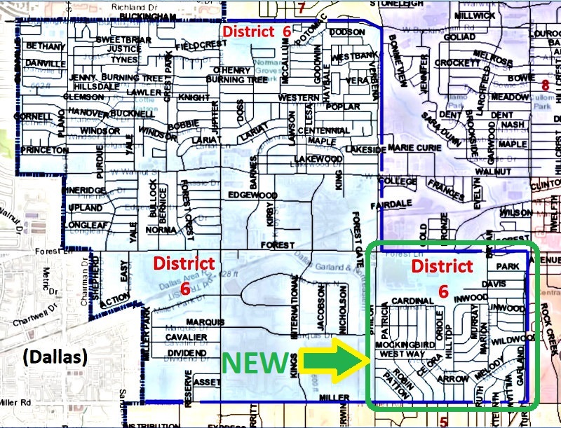
The City of Garland has updated boundaries for its eight Council Districts based on the 2020 national census data. The West Garland Neighborhood Association has historically used the same District 6 boundaries for its use, and will continue that tradition.
Starting in January 2022, the boundaries have been expanded to include extra territory in the southeast corner. Specifically, the new territory now includes from Shiloh Road east to Garland Road, and from Forest Lane south to Miller Road. This is in addition to the existing area that goes from Shiloh Rd west to the City Limit and from Buckingham Rd south to either Forest Ln or Miller Rd.
The following map should help clarify the boundaries: